What to do
Routes through the Lakes of Andorra (Estanys): Best Excursions 2026
May 19, 2026
Updated on November 5, 2026
#Active tourism#Other activities#Summer#Spring
In this article16 sections
Andorra has more than 60 glacial lakes spread across its valleys and parishes. If you're looking for things to do in Andorra outside of ski season, a route through the estanys is the most honest answer I can give you: affordable high mountain landscapes, well-marked trails, and that Pyrenean calm that is almost impossible to find elsewhere. Here are the most beautiful excursions, ordered by difficulty, with all the information you need to set off without surprises.
What are Andorra's estanys?
"Estany" is the Catalan word for lake, and in Andorra, it is used universally. The vast majority are glacial lakes formed thousands of years ago when the glaciers that carved the Pyrenees retreated, leaving basins filled with crystal-clear water above 2,000 meters in altitude. With over 60 spread across the seven parishes, the Principality boasts an unusual density of high mountain lakes in the Pyrenees.
What makes these places special is not just their beauty: many are located within natural areas protected by UNESCO, such as the Madriu-Perafita-Claror Valley (World Heritage Site since 2004) or the Sorteny Valley Natural Park (Biosphere Reserve). Walking to an estany is, in many cases, entering one of Europe's best-preserved Pyrenean ecosystems.
Estanys de Tristaina - Andorra's Star Route
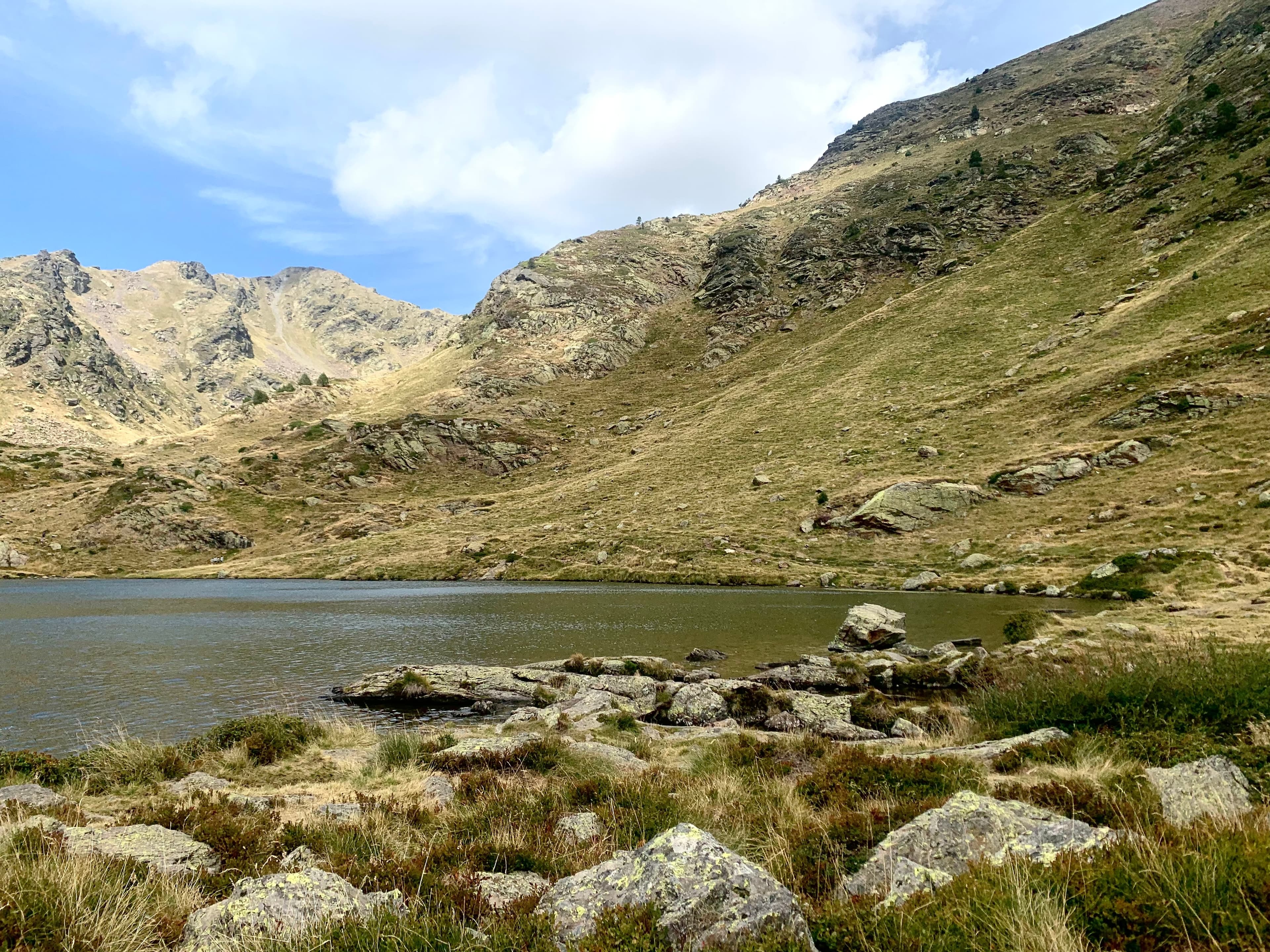
If you only have time for one excursion in Andorra, make it this one. The Tristaina Lakes are the most popular hiking route in the Principality, and for very specific reasons.
Route Details
Parameter | Detail |
Parish | Ordino (Arcalís) |
Distance | 4.4 km (circular) |
Elevation gain | ~210 m |
Duration | 2–3 hours |
Difficulty | Moderate (suitable for families) |
Maximum altitude | ~2,306 m |
Best season | June – October |
The starting point is in the parking lot of the Ordino-Arcalís ski resort, next to La Coma restaurant. From here, the trail marked with yellow signs gently ascends to the first lake: the Estany Primer, the smallest but with the bluest waters of the route. With a 40-minute leisurely walk, you're already at the first viewpoint. This initial section is the easiest and perfectly suitable for children.
Then comes the Estany del Mig, surrounded by scree slopes and passes with a more alpine atmosphere. The last, and largest, is the Estany de Més Amunt, at 2,306 meters, circular in shape and dominated by Pico Tristaina (2,878 m). Swimming is allowed here in summer, although the cool water hints at its glacial origin.
Right at the start of the route, next to the parking lot, you'll find the Arcalís 91 Monument, a four-meter diameter steel ring by sculptor Mauro Staccioli. One of those artistic interventions that, far from clashing, blends perfectly with the landscape.
Insider tip: In summer, road access to Coma del Forat may be closed to private traffic. Check the status before you go and consider taking the resort's gondola.
The area of Ordino has been a UNESCO Biosphere Reserve since October 2020, which adds even more value to this route.
Estanys de Pessons – The Largest Glacial Cirque
If Tristaina is the most popular excursion, the Pessons Cirque is the one that most impresses hiking enthusiasts. It is the largest granitic glacial cirque in Andorra, in the parish of Encamp, and allows you to discover a chain of more than 20 interconnected lakes surrounded by peaks reaching around 2,800 meters.
Route Details
Parameter | Detail |
Parish | Encamp (Grau Roig) |
Distance | ~10–11 km (round trip or circular) |
Positive elevation gain | ~530 m |
Duration | 4 hours (not including stops) |
Difficulty | Medium |
Maximum altitude | ~2,700 m (Pessons Pass) |
Best season | June – September |
The route starts from the El Cubil car park, at the Grau Roig ski resort, on the CG-2 road towards Port d'Envalira. The first slopes are the steepest (about 200 meters of elevation gain in the first 2 kilometers) but once overcome, the route becomes much more gradual.
The forest track leads to the first of the lakes, the Estany Primer de Pessons, where there is a refuge restaurant with unbeatable views. Following the yellow markers, the trail reveals the different 'estanys' one after another: the Forcat, the Rodó, the Meligar, the de les Fonts, the Cap dels Pessons… Each lake has a distinct character, and stopping at some of them for a meal is one of the great pleasures of the excursion.
For the more experienced, there is the option to climb up to the Pessons Pass, with steeper slopes and 360° panoramic views towards the peaks of Montmalús and Pic de Pessons. Those who prefer the circular version can return via the Solana Valley.
Fun fact: The Pessons cirque is part of the Madriu-Perafita-Claror Valley environment, declared a UNESCO World Heritage Site.
Estanys de Juclar – The largest lake in Andorra
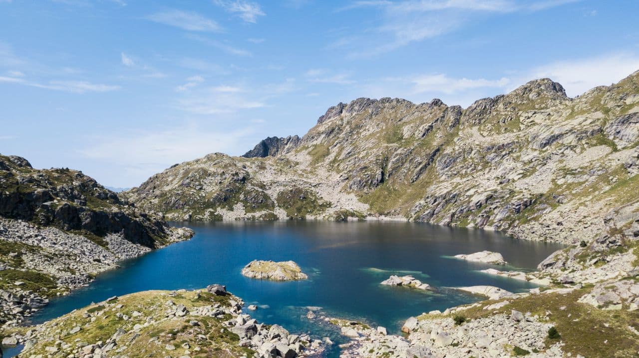
The Incles Valley, in the parish of Canillo, is one of the best-preserved valleys in the Principality and the starting point for one of the most classic routes: the one that leads to the Estanys de Juclar, which include the largest lake in the entire country.
Route details
Parameter | Detail |
Parish | Canillo (Incles Valley) |
Distance | ~12 km (round trip) |
Positive elevation gain | ~583 m |
Duration | 4.5–5 hours |
Difficulty | Medium-High |
Arrival altitude | ~2,294 m (Juclar Refuge) |
Best season | June – September |
The trail begins in the parking lot next to the Restaurante la Oveja Negra, at the bottom of the Incles Valley. The CG-2 road from Andorra la Vella towards France passes through El Tarter; from there, you need to turn off towards the valley.
The first section runs along a wide path with the Incles River on the left. It is one of Andorra's most pastoral valleys: stone huts, grazing animals, the sound of water as a constant soundtrack. After crossing a bridge, the path narrows and the slope increases. It's approximately 4 km of continuous ascent until reaching the Estany Primer de Juclar and, further up, to the Estany Segon and the Juclar Refuge, at 2,294 meters.
For the more ambitious, the route can be extended to the Pic de la Tossa de Juclar, from where the views towards the French side of the border are memorable.
Llac d'Engolasters – Easy and perfect for families
Lake Engolasters is the most accessible lake in Andorra. It is located above Escaldes-Engordany, at an altitude of about 1,500 meters, and is the largest lake below 2,000 meters, with an area of 7 hectares. If you are traveling with small children or are looking for a quiet walk without significant elevation changes, this is your option.
Route details
Parameter | Detail |
Parish | Escaldes-Engordany |
Distance | ~2 km (circular) |
Positive elevation gain | Minimal |
Duration | 45–60 minutes |
Difficulty | Easy |
Altitude | ~1,500 m |
Best time | All year round |
Car access practically reaches the lake. From the car park, a circular path with hardly any elevation gain surrounds the reservoir in about 45 minutes of a leisurely walk. The views over the fir forests and the western slopes of Andorra are very pleasant.
It is an artificial lake (its dam, built in 1934, feeds the country's hydroelectric power station) and has informative panels about the history of the Andorran electricity industry. Swimming is not allowed, but there are several picnic areas and ideal grass for resting. If you are interested in fishing, it is possible to purchase a daily permit in the area.
Note: The path from Bordes de les Pardines also connects to Engolasters and adds a bit more distance and elevation gain for those who want more than just a simple walk.
Estanys de Sorteny – The secret natural park
The Sorteny Valley Natural Park, in the parish of Ordino, is one of the protected areas least known by mass tourism, which makes it one of the most special. Declared a Biosphere Reserve by UNESCO, this valley holds exceptional Pyrenean floral biodiversity.
Route details (to Estanyó)
Parameter | Detail |
Parish | Ordino |
Distance | ~12 km (circular) |
Positive elevation gain | >1,100 m |
Duration | 5–6 hours |
Difficulty | High |
Maximum altitude | ~2,915 m (Pic de l'Estanyó) |
Best time | July – September |
Sorteny Park offers different routes depending on the hiker's level. The most demanding is the ascent to Pic de l'Estanyó (2,915 m), the second highest mountain in Andorra, which starts from the car park at the bottom of the valley next to Riu d'Estanyó. The route crosses alpine meadows, pine forests, and high mountain areas with very characteristic flora before reaching the summit.
For a more accessible version, the circular route through the valley (without reaching the summit) allows you to enjoy the natural environment with less elevation gain and in approximately 3–4 hours.
Insider tip: Guided trekking activities in the Sorteny Valley are available in summer with certified mountain guides. It's an excellent option for those who prefer to be accompanied by an expert who knows the local flora.
Summary table of routes by level
Route | Distance | Elevation gain | Difficulty | Parish | Family-friendly |
Engolasters | ~2 km | Minimal | Easy | Escaldes-Engordany | Yes |
Tristaina | 4.4 km | ~210 m | Moderate | Ordino | Yes |
Pessons | ~10–11 km | ~530 m | Medium | Encamp | With older children |
Juclar | ~12 km | ~583 m | Medium-High | Canillo | With older children |
Sorteny | ~12 km | >1,100 m | High | Ordino | Only fit adults |
When to do these routes
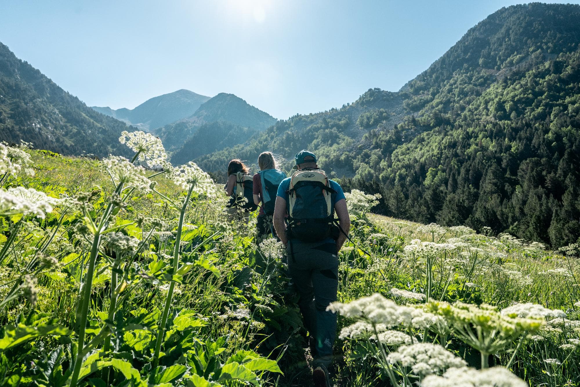
The optimal season for hiking routes around Andorra's lakes is from June to the end of September. During these months, high mountain trails are free of snow, refuges are open, and alpine flora is at its peak.
July and August are the busiest months, especially on routes like Tristaina. If you can, opt for weekdays or early departures (before 9 am) to enjoy the silence.
In June and September, conditions are excellent, and there are far fewer people. Autumn adds exceptional colors to the forests of the lower valleys.
The Engolasters routes and the lower section of Incles can be done almost all year round, except on snowy or icy days.
What to pack in your backpack
This list is not optional if you go above 2,000 meters in the Pyrenees:
- Hiking boots (sneakers are not suitable for routes like Pessons or Juclar)
- Layered clothing (in summer it can reach 25°C at the bottom and 10°C at the top)
- Waterproof jacket (afternoon storms are common in July and August)
- Water (minimum 1.5 L per person; in high mountains, water sources are not guaranteed)
- Food (sandwich or energy lunch; some shelters have kitchens, but not all)
- Sunscreen and sunglasses (altitude multiplies UV intensity)
- Trekking poles (recommended for descents with a lot of loose rock)
- Map or GPS track (although signage is good, having the track downloaded without internet is essential)
- Mountain insurance (rescue in Andorra can be costly if you don't have coverage)
Common hiking mistakes in Andorra
I've seen enough summer rescues to share this with firsthand knowledge:
1. Leaving too late. Afternoon storms are frequent in July and August. Leaving at 11 am for a 5-hour route is risky. Ideally: start before 8 am.
2. Relying on the capital's weather. In Andorra la Vella it can be sunny, and in Pessons there can be fog and hail. Always check the specific altitude forecast with the Andorran meteorological service (AEMET does not cover the Principality in the same way).
3. Wearing inappropriate footwear. Routes with loose rock like Pessons or Juclar require boots with trekking soles. With sneakers, the risk of sprains is real.
4. Not downloading the track. Mobile coverage disappears in many valleys above 2,000 meters. If you use Google Maps or an online app, download the route before you leave.
5. Swimming without considering the temperature. High mountain lakes are only a few degrees even in August. Swimming is allowed in some 'estanys' (like Més Amunt in Tristaina), but an impulsive dip can result in hypothermia if you're not prepared.
6. Not having mountain insurance. In Andorra, a helicopter rescue can be costly if you don't have specific coverage. Check your policy or get temporary insurance.
Frequently Asked Questions
JArticle written and updated byJoan